

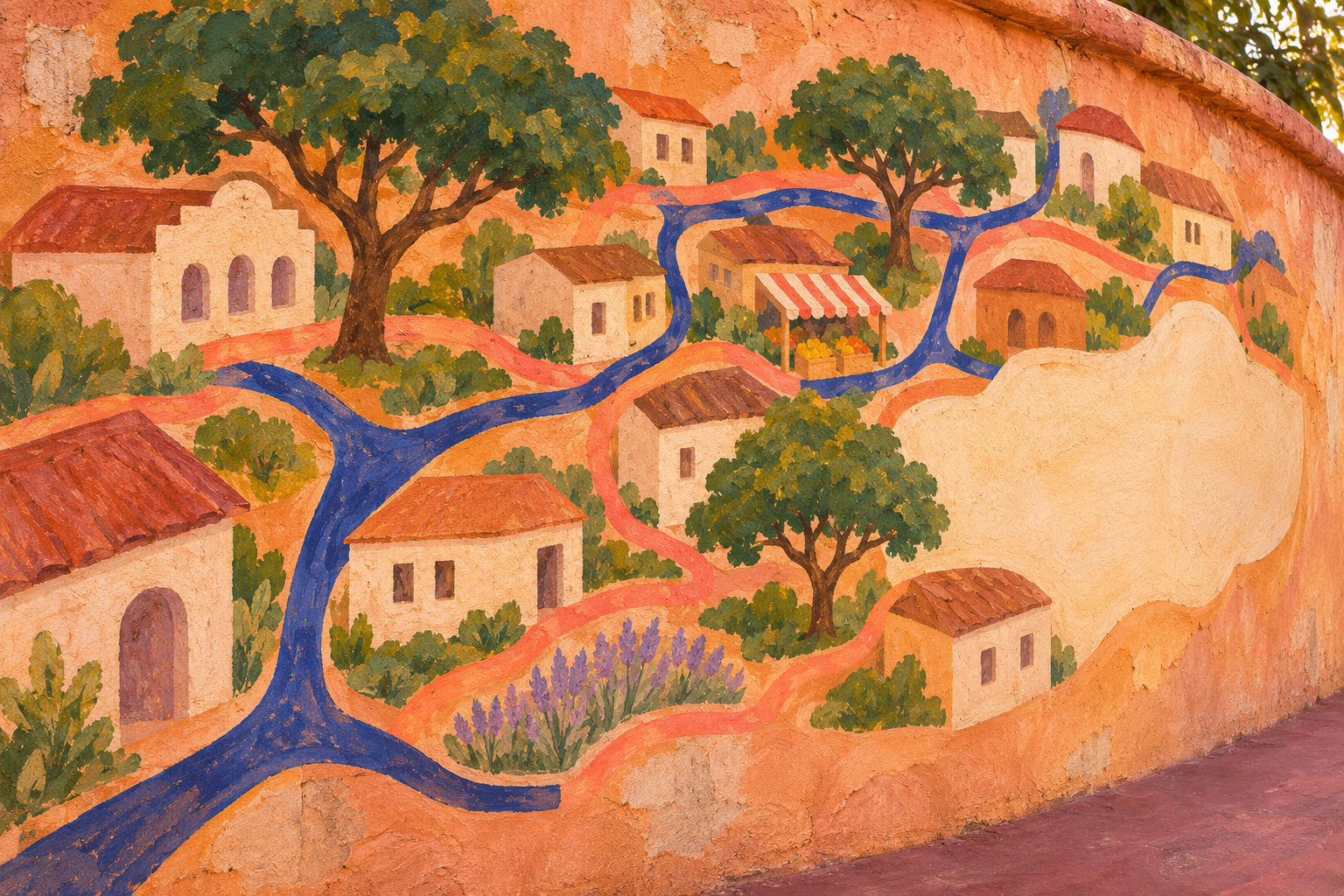
Room for Another Story. Original editorial painting of an imagined neighborhood map mural, with paths, homes, trees and an unfinished space. A reflection on local knowledge that remains open to correction.
Participatory mapping can make valued places and overlooked barriers visible, when residents help decide what belongs on the map and what must remain protected
By Arbab Naseebullah Kasi, Chief Executive Officer - CEO, Feel Worldwide Foundation Inc.
Imagine a neighborhood map with every street neatly drawn and a large empty shape between two roads. To someone passing through, that shape may look unimportant. To residents, it might contain the tree where older people rest, the shortcut that becomes impassable after rain, and the small market that makes an evening meal affordable.
This is a hypothetical scene, but it reveals a practical problem. A map can be accurate about street geometry and incomplete about everyday life.
People know places through use. They know which entrance is open, where a wheelchair cannot pass, where a bus actually stops, and which meeting place feels welcoming. They also know things that should never become a public pin on a screen.
Participatory mapping gives that knowledge a form people can examine together. Its value depends on who shapes the questions, whose experience is included, how uncertainty is recorded, and who controls the result. A beautifully finished map can still leave the neighborhood poorly understood.
Begin with a decision the map can help
Before choosing software, ask what people want to understand or change. Perhaps residents want to identify usable routes to a community center, document places of cultural importance, or show where public services are difficult to reach. Each purpose calls for different information.
A map of valued places should not become a household register simply because an application offers extra fields. A route-access exercise does not need people’s medical histories. Narrowing the purpose makes it easier to explain the work, reduce unnecessary collection and judge whether the result helped.
The Global Land Tool Network’s account of participatory enumeration describes residents taking part across the process, from its design and management to analysis and use. That is a useful standard for the word participatory. Local people should have influence before the categories have been fixed and after the information has been collected.
Agree on the intended audience, the area being considered and the limits of the exercise. Explain whether an authority has committed to consider the findings or whether the map will support a future conversation. Do not imply that taking part guarantees a new service, investment or recognition of a claim.
Map what people value, as well as what they lack
Starting only with problems can produce a picture of a community as a collection of deficiencies. Ask what residents would be sorry to lose. A repair shop, informal play space, shared garden or gathering place may hold practical and social value that an inventory of formal facilities misses.
Let people explain why a place matters. A shaded corner may be important because it offers a resting point on a long journey. A small shop may offer credit, familiar language or help reading a notice. The location alone does not convey that relationship.
Different groups may value the same place for different reasons, or experience it differently. Record that variation without forcing agreement. A busy market can provide livelihoods and create a difficult crossing. Both observations can inform a better design.
Names matter too. Preserve local names alongside official ones where useful and safe. Ask who uses each name and whether publishing it could create a dispute or expose a place people wish to protect. The goal is a usable account of local experience, with room for more than one perspective.
Make participation possible before calling it inclusive
An open invitation reaches people who hear about it, have time, can travel and feel comfortable attending. It may miss tenants, shift workers, people with disabilities, minority-language speakers, newer arrivals or residents who distrust the organizers.
Plan several ways to contribute. Offer accessible venues and times, interpretation where needed, smaller conversations, paper-based activities and ways to comment without using a smartphone. Budget for reasonable participation costs. Ask people what would help rather than assuming that one arrangement works for everyone.
UN-Habitat’s Count Me In, published through GLTN, asks who speaks for residents, whose interests they represent, which groups have been left out and how accountability is maintained. Those questions belong in the design of a community map, not only in its final report.
The IFRC’s PASSA manual also makes a useful distinction: including women and men in a group is insufficient unless both have meaningful opportunities to participate. Attendance and influence are different things.
Keep a proportionate record of the areas and perspectives reached, without collecting identifying details that are unnecessary or unsafe. Describe gaps plainly. A volunteer mapping group can produce valuable knowledge without being a statistically representative sample. Neither a crowded workshop nor a large number of mapped features proves that every resident’s experience has been heard.
Follow the journey, not just the destination
A clinic marker tells a reader where a building stands. It may say little about whether a person can reach the entrance, afford the journey or arrive during opening hours. Access often depends on the route and the circumstances of travel.
For a route-mapping exercise, invite participants to describe the whole journey. Where do they have to stop? Which crossing feels difficult? Does a gate close in the evening? What changes in rain, heat or darkness? Distinguish an observed physical condition from an individual account of experience. Both are useful, but they answer different questions.
An accessibility label should explain its basis. One person’s successful visit does not establish that a building is accessible to everyone. Record specific features, such as steps at an entrance or the availability of seating, and seek relevant technical assessment when a decision requires it.
In its shelter-focused mapping activity, the IFRC recommends that participants make their own maps, visit selected places and revise the maps afterward. The guidance also recognizes that people may not want their homes visited or discussed. Its sequence offers a practical lesson: compare what is drawn with what can be checked, while respecting refusal. PASSA, Activity 2.
A map used for emergency planning needs additional care. A route discussed by residents should not be presented as a certified safe evacuation route without appropriate assessment and coordination. Precision on a screen can create more confidence than the evidence deserves.
What a documented project can show
Open Schools Kenya offers a concrete example of community-generated information becoming easier to find. In its March 2015 launch report, project partner Development Gateway said users could access profiles for nearly 350 schools in Kibera. Citizen-collected information was linked with other education sources and made available online and offline. Read the project’s launch account.
That figure describes reported coverage at that time. It is not a current school count, an independent completeness audit or evidence that mapping improved learning outcomes. It does show the practical scale of a documented effort to make previously difficult-to-find school information usable.
In a 2017 practitioner reflection on Map Kibera, Erica Hagen described research using interviews, focus groups and reviews of social media and visitor records. Preliminary findings included examples of organizations using the information to target activities, the importance of trust, and continuing difficulties with updates and internet access.
Hagen explicitly said analysis was still incomplete. This is qualitative practitioner evidence, useful for understanding possible uses and implementation challenges. It cannot establish a measured causal effect or show how widely every benefit was experienced.
Together, these accounts suggest a sensible expectation for new mapping work: useful information may help people coordinate, locate services or make a stronger case for attention. The project must still investigate who uses the map, what decisions change and whose needs remain unmet.
Some places need protection more than visibility
The decision to collect a location and the decision to publish it should be considered separately. A place can be important to understand and dangerous to expose.
OCHA’s Centre for Humanitarian Data explains that sensitivity depends on context. A medical facility’s coordinates, for example, can put patients and staff at risk in a conflict setting even when similar information would be less sensitive elsewhere. Removing people’s names does not necessarily remove the danger. OCHA’s guidance on assessing data sensitivity.
For a community exercise, consider confidential shelters, culturally restricted sites, informal gathering places used by people facing persecution, and the homes of people who have described threats. Do not ask someone to reveal a sensitive location in front of a group. In some circumstances, the safest choice is to leave it uncollected.
Explain where information will go before accepting a contribution. A map shared within a small group is different from one uploaded to a public, reusable database. Once public information has been copied, removing the original may not remove those copies. Do not promise complete withdrawal when the publishing method cannot provide it.
Where sharing is justified, use the least detail needed. A public map might show a broad service area while a restricted record contains operational information for authorized people. Even that arrangement needs a risk review: a broad area or a seemingly harmless combination of details may still reveal a protected location.
Agree who can approve publication, who can access restricted material, how long it will be kept and how a concern can be raised. Community approval does not give organizers permission to disclose every individual’s personal information. Applicable privacy duties and the rights of affected people still matter.
Keep disagreement and uncertainty visible
Maps invite clean lines. Community knowledge often arrives as overlapping accounts, approximate locations and changes over time. Do not erase those features merely to make the result look polished.
A path may be usable in one season and blocked in another. A facility may have moved. Two groups may describe different boundaries for the same neighborhood. Record dates, sources and unresolved differences in a form appropriate to the audience, without exposing confidential contributors.
Use language such as reported, observed, not yet checked or seasonally available where it is warranted. A blank area may mean it was not covered, that information was withheld for safety, or that the feature does not exist. Those meanings should not be silently treated as interchangeable.
Offer a correction process that people can actually use. Someone should be able to report a wrong entrance or a harmful disclosure without mastering the mapping software. Check the claim, document the correction and tell affected users when a change matters.
Avoid publishing allegations about an identifiable person or household as if they were verified geographic facts. A safety concern may require a confidential response through an appropriate channel rather than a public marker that could invite retaliation.
Be clear about what a map cannot establish
A community map is not, by itself, legal title to land. Drawing a boundary does not settle competing rights, establish permission to enter, or replace the procedures required under the applicable legal system.
GLTN’s Social Tenure Domain Model discussion distinguishes a range of tenure relationships and claims rather than treating individual freehold title as the only form worth recording. That is a reason to describe rights carefully, not a basis for promising that a mapping exercise creates them.
Where tenure or disputed boundaries are involved, obtain qualified local advice, explain the status of the record and establish a fair way to handle objections. Participatory evidence may contribute to a recognized process. Its legal effect depends on the jurisdiction, the evidence and the process through which it is considered.
A map also does not automatically authorize a budget, rank everyone’s priorities or prove that a proposed project has community consent. Those are separate decisions. Mapping can make their geographic implications clearer while leaving the decision-making process explicit and accountable.
Leave a map people can keep using
Decide who will maintain the map before the first public version appears. A map without an update plan can preserve yesterday’s barriers and overlook today’s services. Set a review schedule that matches how quickly the information changes, and show when important entries were last checked.
Return usable copies to the people who contributed. An online map may need a printed companion, a large-text description or an accessible list of services and routes. Color alone should not carry every distinction. Test whether intended users can understand the symbols and find what they need.
For a manageable first effort, choose one question and a limited area. Recruit beyond the familiar committee, explain privacy choices, map the relevant places, verify what can safely be checked, and return the draft for correction. Publish only the information approved for that audience. Then ask whether it helped anyone make a better decision.
Success may be a corrected service location, a documented access barrier that receives a response, or a valued gathering place considered before a redesign. Record the response and its limits rather than counting the map’s existence as the outcome.
A community deserves a map in which people can recognize their lives, challenge mistakes and protect what should remain private. The most useful map will leave room for another resident’s knowledge and a clear way for that knowledge to change what happens next.
To explore a possible collaboration with Feel Worldwide Foundation Inc. around community-informed mapping, accessible local information or practical learning partnerships, use our partnership inquiry form. Proposals require review; an inquiry does not promise mapping services, land recognition or funding. If you would like to support the Foundation’s mission, you can make a donation.
